Welcome to Precision Solutions GIS & Land Survey Engineering Consultancy
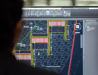
Geomatics Engineering Services
Expert consulting in geomatics engineering for precise data collection and analysis solutions.
Survey Services


Our Survey Services provide precise land surveying and mapping solutions using advanced technology for accurate data collection.


GIS Services
Our GIS Services offer innovative geospatial analysis and mapping to support informed decision-making in urban planning and infrastructure projects.
Our AI-Driven Services combine artificial intelligence with surveying and GIS to deliver smart, data-driven insights for diverse industries.
AI Services


We provide expert surveying solutions across various industries, including government agencies for urban planning and infrastructure, construction and engineering firms for precise project execution, and real estate developers for accurate land measurements. Our services support oil, gas, and mining companies in exploration and land assessment, as well as transportation and infrastructure authorities in planning roads, bridges, and transit systems. We assist utilities and energy providers in site planning, environmental organizations in sustainability efforts, and agriculture and forestry sectors in resource management. Additionally, we cater to marine and offshore industries with hydrographic mapping and legal consultants requiring precise land data for property disputes and boundary verification.
Industries We Serve
Our Location
Here at Precision Solutions, we provide expert surveying and engineering services using advanced technology to deliver accurate and reliable results for every project.
Location
Office No. 7, 7th Floor, Tower 1, Mazyad Mall, Abu Dhabi, UAE

Where Innovation Meets Precision in Land Surveying
© 2025. All rights reserved.
Services
Contact us
Our Partners


Cairo Governorate , Egypt
>> Survey Service
Quick Links
Office No. 7, 7th Floor, Tower 1, Mazyad Mall, Abu Dhabi, UAE
@